The New York State Museum, in collaboration with the Open Space Institute and Stockbridge Munsee Mohican Tribal Preservation Office, recently completed a controlled surface artifact collection and a magnetic susceptibility survey (MS) at the location of a tenant house owned by former Albany mayor Volkert Douw in the 1790s and likely occupied by an African American family during the 1830s. The house was probably destroyed in the 1850s leaving only a thin scatter of artifacts in an agricultural field.
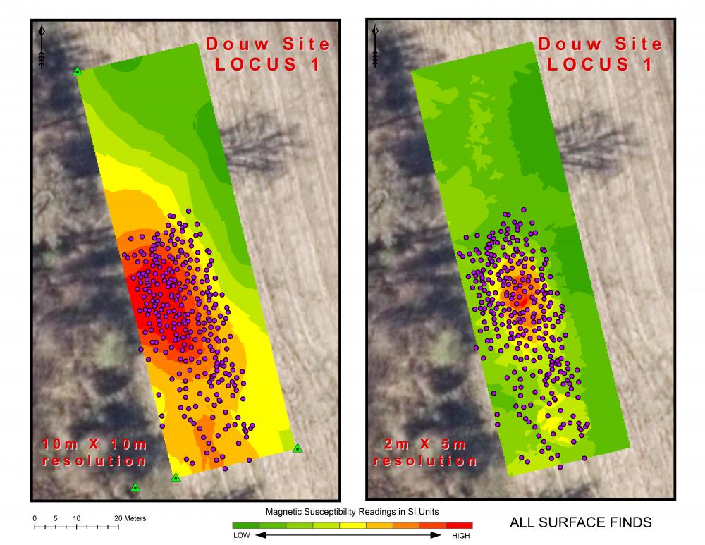
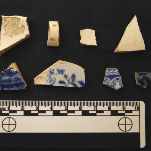
MS is a non-invasive geophysical technique using a meter to measure how “magnetizable soil is, which can be a marker of past human activity." An MS survey, followed by a systematic pedestrian survey or “walkover" of a 30 by 100-meter area at the Douw Site, were completed during the spring of 2019. Some artifacts recovered are shown below. A total of 794 artifacts at 549 discrete locations were recorded in the field using a centimeter level, mapping grade Global Navigation Satellite System. Data from each survey were incorporated into a Geographic Information Systems for analysis, query and visualization. Some of the results seen in the illustration below show a strong visual/spatial correlation between the surface artifact finds and MS “hot spots”. Further exploration of the site using traditional archaeological testing will be guided by the combined results of the non-destructive MS and controlled surface collection surveys.
Controlled surface artifact collection combined with magnetic susceptibility yields tantalizing results

Magnetic susceptibility results overlaid with surface artifact locations show a strong correlation between finds and MS "hot spots"


